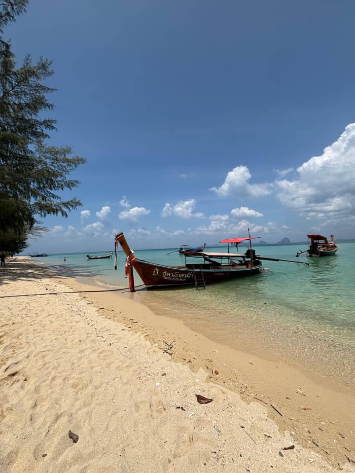
The base
Koh Lanta Yai
The main island
See the toursWhere is your stop
See 29 route stops
Choose a route and tap a pin or stop to see its note and open it in Google Maps.
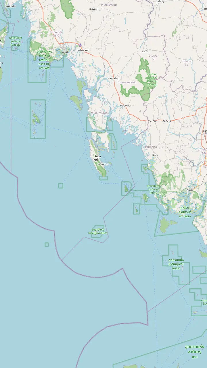
Baan Saladan is where the car ferry and boats from the mainland arrive, and the main tourist office stands here.
Google MapsLanta Old Town on the east coast is the island's capital; several longtail boat days start from its pier.
Google MapsA paved road runs the length of the island to the park headquarters and the lighthouse at the southern end, the Laem Tanot side.
Google MapsTAT places Ngai Island in Ko Lanta District, Krabi, and the park authority groups it with Ko Ma.
Google MapsKo Kradan belongs to Hat Chao Mai National Park in Trang, and TAT describes its beach as having no roads.
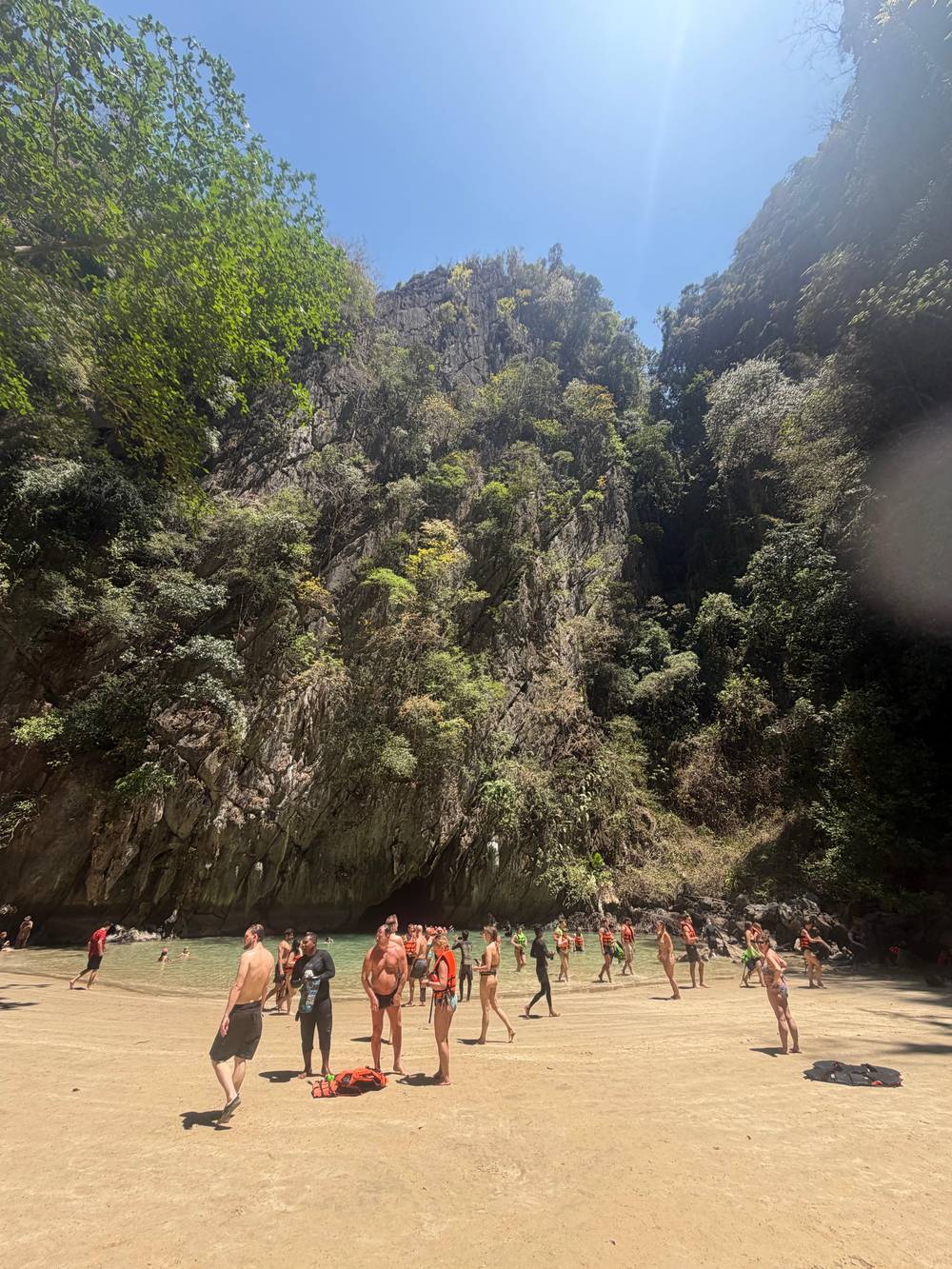
Google MapsKo Muk is listed in Hat Chao Mai National Park, and the Emerald Cave on the island is a doline that visitors may wade through.
Google MapsKo Rok sits in Mu Ko Lanta National Park, and the park closes it from May 16 to November 15.
Google MapsKo Ha, the five-island group, belongs to Mu Ko Lanta National Marine Park.
Google Maps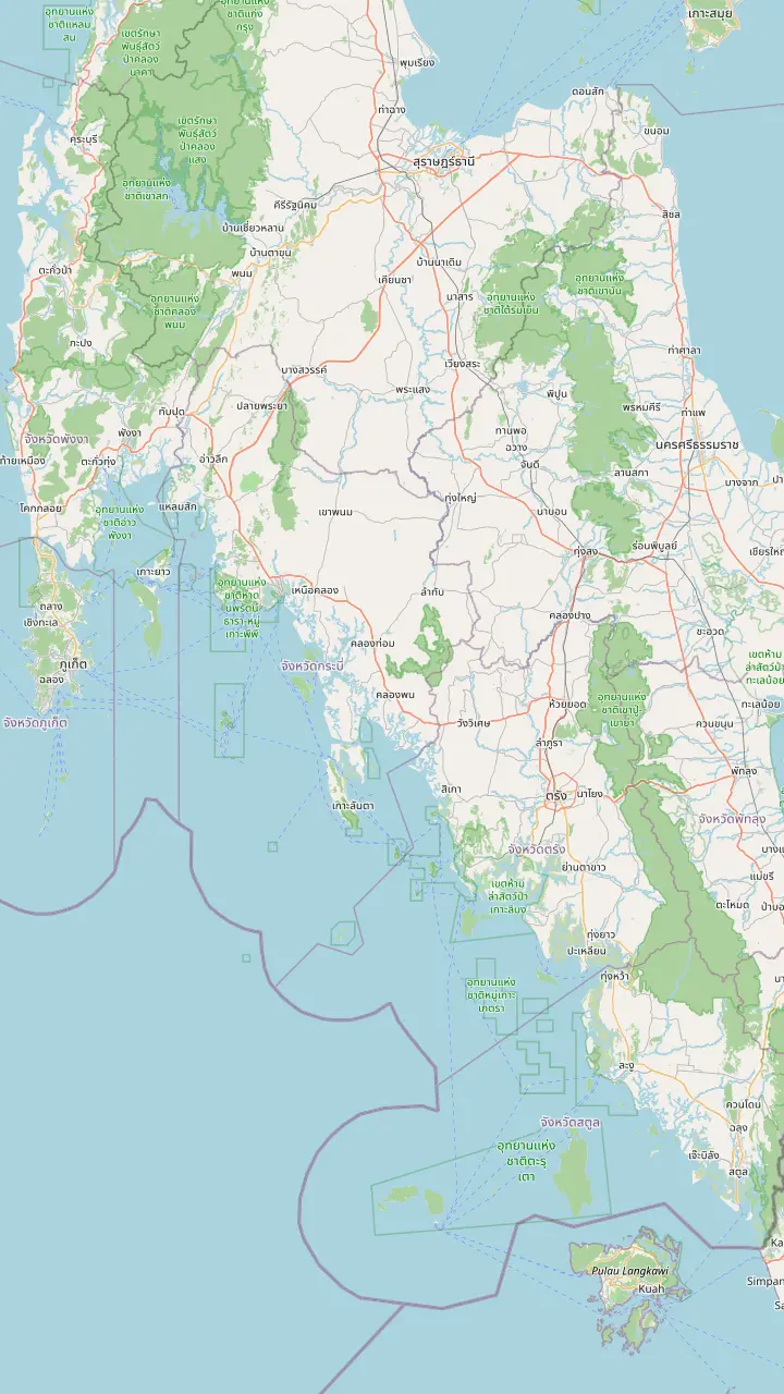
The airport on the Krabi side; one private transfer listing joins it to hotels on Koh Lanta.
Google MapsBoats to Ko Lanta leave Khlong Chi Lat Pier in Krabi at 11.00 and arrive about 13.00 for about 350 baht, according to the park authority.
Google MapsA boat leaves Ao Ton Sai Pier on Ko Phi Phi at 8.00 for Ko Lanta, arriving about 9.30, the park authority says.
Google MapsBaan Saladan is where the car ferry and boats from the mainland arrive, and the main tourist office stands here.
Google MapsLanta Old Town on the east coast is the island's capital; several longtail boat days start from its pier.
Google MapsTAT notes that Trang has a domestic airport and serves as a gateway to southern Thailand's quieter beaches.
Google Maps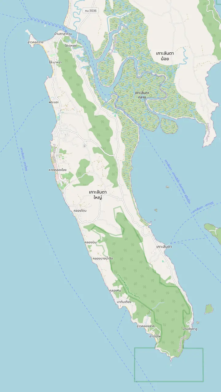
Klong Dao is one of two Ko Lanta beaches in the 2017 beach smoking ban TAT announced.
Google MapsPhra Ae, also called Long Beach, is said to have the softest and finest white sand of the Krabi beaches.
Google MapsKlong Khong sits between Phra Ae and Klong Nin on the west coast, and a listing's pickup round collects guests here at 8:20 AM.
Google MapsKlong Nin Beach, on the west coast, has a pickup point at 8:20 AM on one longtail day.
Google MapsKantiang is the earliest pickup point after Klongjark on one longtail listing, at 8:00 AM.
Google MapsBamboo Bay lies south of Kantiang Bay on the map, towards the Laem Tanot end of the island.
Google MapsLanta Old Town on the east coast is the island's capital; several longtail boat days start from its pier.
Google MapsBaan Saladan is where the car ferry and boats from the mainland arrive, and the main tourist office stands here.
Google MapsA paved road runs the length of the island to the park headquarters and the lighthouse at the southern end, the Laem Tanot side.
Google Maps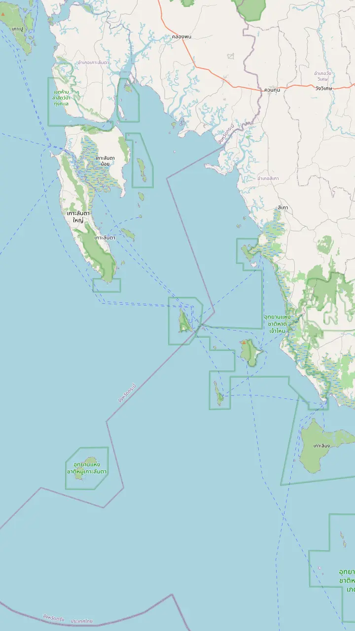
Lanta Old Town on the east coast is the island's capital; several longtail boat days start from its pier.
Google MapsKo Chueak is one of the Hat Chao Mai islands, and several longtail days make it the first stop.
Google MapsKo Waen is another island of Hat Chao Mai National Park.
Google MapsKo Muk is listed in Hat Chao Mai National Park, and the Emerald Cave on the island is a doline that visitors may wade through.
Google MapsTAT places Ngai Island in Ko Lanta District, Krabi, and the park authority groups it with Ko Ma.
Google MapsKo Kradan belongs to Hat Chao Mai National Park in Trang, and TAT describes its beach as having no roads.
Google MapsMap data: © OpenStreetMap contributors
A map-first guide to the island in Krabi province: how big it is, how the villages and beaches line up, which islands lie nearby and how long the crossings take.
Editorial team, kohlanta4islands.click · Updated November 16, 2026 · A 8 min read
Quick look
Koh Lanta is an island district of Krabi province on the Andaman Sea coast of southern Thailand. The national park authority places Mu Ko Lanta National Park in Ko Lanta District, Krabi Province, and says it consists of 25 islands that can be divided into four groups.1 The tourism authority gives the bigger picture: the island lies just south of the Andaman coast's prime attractions, Krabi, Koh Phi Phi and Phuket, and has kept a laid-back atmosphere.5 On the map above, start with the pin for Ban Saladan on the northern tip and read south from there.
The question of where Koh Lanta is usually hides a second question, which is how it relates to the places people have heard of. Krabi lies to the north, with its airport and the Khlong Chi Lat pier, and Phi Phi Don lies north-west across open water; both appear on the access panel of the map. Trang province, with its own airport and the islands of Hat Chao Mai National Park, lies to the south-east, and the Emerald Cave on Ko Muk belongs to that side.6
Koh Lanta is not one island but a small archipelago in one park. The group that bears the name holds 16 large and small islands, among them Ko Lanta Yai, Ko Talabeng and Ko Mai Ngam.7 Ko Lanta Yai is the big island where almost everyone stays, and it is the one the road, the ferries and the beaches in this guide refer to. The other groups of the park include the Ko Ngai group, the Ko Rok group and the Ko Ha group, which sit farther offshore.8,9
Place the pins
| Place | Province or park | How it relates |
|---|---|---|
| Koh Lanta Yai | Krabi, Ko Lanta District1 | The main island, over 30 km long2 |
| Baan Saladan | Krabi | Landing point for car ferries and boats10 |
| Lanta Old Town | Krabi | The island's capital, on the east coast13 |
| Ko Ngai | Mu Ko Lanta, Krabi18 | Lunch stop on the longtail day |
| Ko Kradan | Hat Chao Mai, Trang6 | Beach stop, boat from Koh Lanta19 |
| Ko Muk | Hat Chao Mai, Trang6 | Home of the Emerald Cave20 |
| Ko Rok and Ko Ha | Mu Ko Lanta, Krabi9 | Far snorkeling trips21 |
Places from the park authority and TAT; pin positions from OpenStreetMap data on the map above.1,6
Koh Lanta Yai is long, narrow and green. Measured by TAT, it runs over 30 km from end to end and is 6 km across, with nine golden beaches, mangroves, waterfalls and forested hills.2 The park authority adds a rain forest of 19.42 square kilometers along the Lan Ta mountain range,15 and a highest peak of 488 meters.7 Those figures explain the layout: beaches on the west, hills in the middle and the old town on the quiet east side.
The whole national park is much larger than the island. The park authority gives its area as 134 square kilometers,3 which includes the small islands to the south and west, and the sea around them. Hat Chao Mai National Park in Trang is larger still, at approximately 231 square kilometers, and its west border meets the sea, Ko Ngai, Ko Ma and Mu Ko Lanta National Park.16,17 On a map the two parks touch at the southern islands, which is why one boat trip can cross both.
For planning, the length is what counts. A ride from the north to the far south takes real time even on a paved road, and beaches at opposite ends feel like different resorts. One road joins them, running to the park headquarters and the lighthouse at the southern end,14 and the sensible way to use the map is to pick a coast section and stay within it, then leave the other end of the island for another day or a different base.
Two settlements anchor the island. Baan Saladan, at the northern tip, holds the main tourist office and is where car ferries and boats arrive; banks, dive shops, clinics and motorbike rental cluster there.10 Baan Koh Lanta, or Lanta Old Town, sits on the east coast as the island's capital and has the post office.13 On the map they are the two ends of the northern half, one facing the mainland, the other facing the islands. That is how big Koh Lanta is on the ground, and it explains why distances along the road matter.
Between them and the south lie the beaches of the west coast. The map runs through them from north to south: Klong Dao, Phra Ae or Long Beach, Klong Khong, Klong Nin, Kantiang Bay and Bamboo Bay. TAT's island page names Aow Nui, Hat Kor Kwang and Hat Khlong Dawn among its places to explore,24 and a TAT caption shows the Laem Tanot Viewpoint.25 Each beach has its own character, and the map helps you pick a stretch rather than a name.
The east side is where the culture sits. Sang Ka-U is a village of Urak Lawoi, sea nomads who settled on Lanta Island of Krabi province, per TAT.26 Looking east from the old town you see Ko Lanta Noi, the smaller island between Lanta Yai and the mainland, and the road in crosses it by car ferry.22 A visitor who arrives by road therefore meets the smaller island before the main one, which is a neat way to understand the geography.
Pick your question
Say what you are trying to place and the map points to the answer.
If Which province is it in?
Krabi
The park lies in Ko Lanta District, Krabi.1
If Where do boats arrive?
Baan Saladan
Car ferry and boat arrivals land there.10
If Where is the Emerald Cave?
Ko Muk, in Trang
It is listed in Hat Chao Mai National Park.6
If Where is Phi Phi from here?
North-west by boat
A ferry from Ao Ton Sai arrives at about 9.30.23
If Which part is the quietest?
The south and the southern islands
TAT notes greater seclusion on Ngai, Kradan and Muk.4
Three scales
The base
The main island
See the tours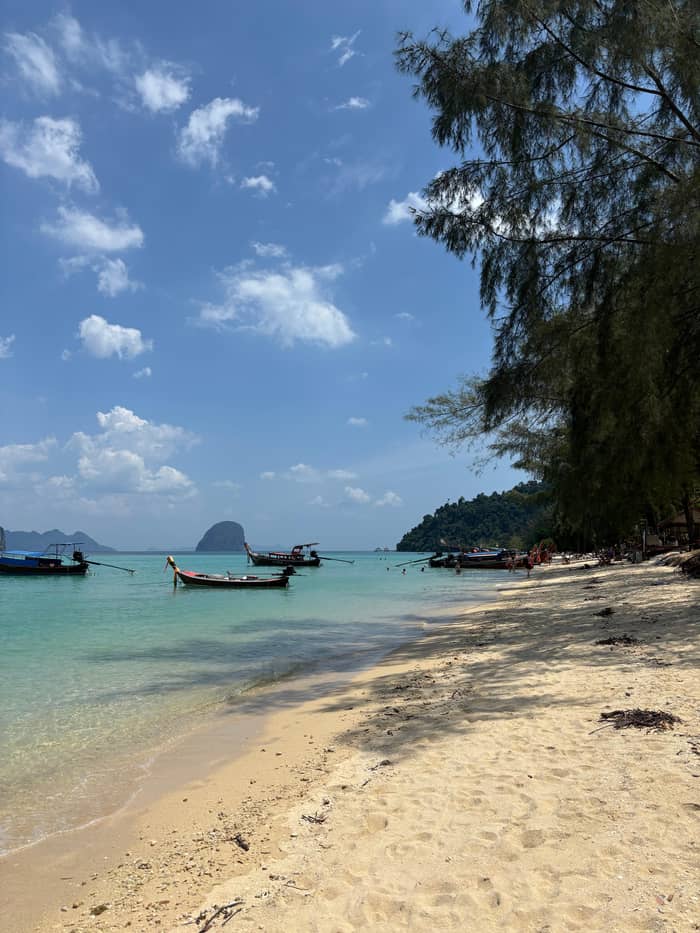
The stepping stone
The smaller island
See the tours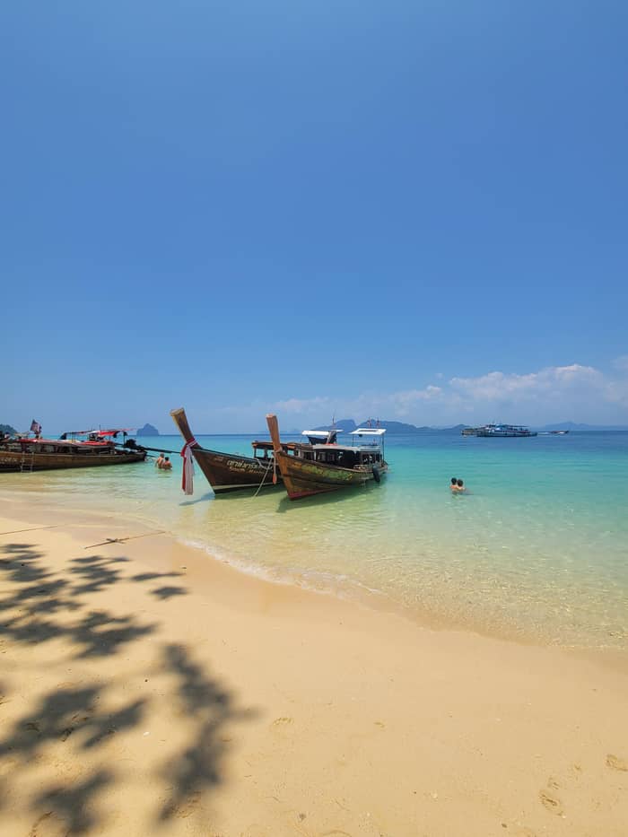
The day trip
Ngai, Kradan, Muk
See the toursThe islands that give Koh Lanta its reputation lie to the south and the south-east. TAT says that just south of Koh Lanta Yai lay Koh Ngai, Koh Kradan and Koh Muk, all offering equally stunning beaches and snorkelling and even greater seclusion.4 Ko Ngai is in Ko Lanta District of Krabi, while Ko Kradan and Ko Muk are in Hat Chao Mai National Park in Trang,18,6 so a boat day from Koh Lanta crosses a provincial line along the way.
The far reefs lie in other directions. TAT describes Ko Ha as five islands in the marine park, and names Ko Rok as where the busiest boat excursion out of Ko Lanta heads.9,21 On the map the Ko Ha pin sits west of the island and the Ko Rok pin south, so they are separate trips and not neighbours of the longtail day. Phi Phi lies north-west: a ferry leaves Ao Ton Sai Pier at 8.00 and reaches Ko Lanta at about 9.30, the park authority says.23
Phuket is farther still, across Phang Nga Bay, and Krabi province as a whole has 154 islands plus three national parks, according to TAT.32 That is the context for the question of where Koh Lanta is: it is one of many islands, and one of the quieter ones. TAT says Ko Lanta suits families, couples, backpackers and scuba divers who want a Thai island that has not succumbed to overdevelopment but still has many options for accommodation and activities.33
Same map, different day
Set the group size to price each day from the island in total.
Side-by-side: 4 options
Set the group size to price each day from the island in total.
≈
View≈
View≈
View≈
ViewConverted at the ECB reference rate, from-prices as listed by GetYourGuide. The precise amount is shown when you book.
North to south
North tip
Where car ferries and boats arrive, with the tourist office.10
North-west coast
A beach named in the 2017 smoking ban.11
West coast
Also called Long Beach, with fine white sand.12
East coast
The capital, facing the eastern islands.13
South-west
Bays toward the southern end of the island.
Far south
The park headquarters and the lighthouse.14
The map shows direction, and listings and the park authority give the times. The park authority says a ferry leaves Khlong Chi Lat Pier in Krabi at 11.00 and arrives in Ko Lanta at about 13.00, for about 350 baht.23 A ferry transfer listing from Koh Lanta to the same pier takes 2.5 hours. A private transfer between Krabi Airport and Koh Lanta takes about 2 hours, and another listing gives 2 to 2.5 hours. Phuket, Phi Phi and Lanta are linked by a speedboat transfer that the listing gives as 40 to 100 minutes, varying with the route.
By road the numbers grow. The park authority says Laem Tanot is approximately 850 kilometers from Bangkok, through Krabi and Trang, then Ban Hua Hin and two car ferries, first to Ko Lanta Noi and then to Ko Lanta Yai.22 The same page warns that some routes on the islands are steep and may need a 4WD vehicle.22 Most visitors do not drive that far; they fly to Krabi or Trang and take a transfer, and the dedicated guide to getting there covers the options and prices in detail.
Within the archipelago, the longtail crossings are shorter than they look. The site tour needs 1.5 hours of boat each way to reach the eastern islands, while the Rok and Haa speedboat takes 30 minutes between island groups. Think of Koh Lanta Yai as the center of a wheel, with Krabi and Phi Phi to the north, Ngai, Kradan and Muk to the south-east, Rok and Haa to the south and west, and Trang to the east. Every excursion on this site starts from that center.
Video
The World From Above on YouTube · Playback files load only once you tap play.
Koh Lanta Yai is 6km wide and over 30-km long, featuring nine golden sand beaches and diverse terrain, including mangroves, waterfalls, and forested hills.
Before you pin it
What is Koh Lanta, in a sentence? A long, laid-back island that has grown into a beach destination without losing its mangroves, villages and park. TAT sums it up as calm and relaxing, with beaches, restaurants and bars, an old town and mangroves,34 and says it has slowly gained some of Thailand's finest beach resorts.35 The park side is conservation-minded: Lanta Archipelago National Park was recognised in 2025 for a community marine conservation project under TAT's Krabi Prototype.36
It is also a place with a history of its own. Urak Lawoi sea nomads have settled on the island, and TAT describes how they build a big trap called a Lop, large enough for as many as 10 people, from natural materials.26,37 The island's villages, the old town and the park headquarters together give a different picture from the resort strips of Phuket, and that contrast is what many travelers come for. The geography on this page explains how the pieces fit.
Finally, use the map in the order you will travel. Start from your arrival point, whether that is Ban Saladan or the old town pier, pick your beach from the west-coast panel and note the departure pier for the boats. The longtail day to the islands leaves from the east side, the far snorkeling trips leave from Saladan Pier and the beaches are all along the road in between. Save the offline map before you cross, since signal can be uneven in the south.
FAQ
Mu Ko Lanta National Park lies in Ko Lanta District, Krabi Province.1
The park has 25 islands in four groups, and the main island is Ko Lanta Yai.1
TAT says it is 6 km wide and over 30 km long.2
TAT says it is the island's capital and holds the post office.13
TAT places them just south of Koh Lanta Yai.4
The park authority counts approximately 850 kilometers to Laem Tanot.22
Car ferry and boat arrivals land there, per TAT.10
Ko Muk belongs to Hat Chao Mai National Park.6
Sources
Further reading
Heading to Koh Lanta? Ask a real person here.