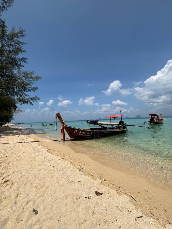
Practical
Saladan
Services and arrivals
See the boat daysWhere is your stop
See 29 route stops
Choose a route and tap a pin or stop to see its note and open it in Google Maps.
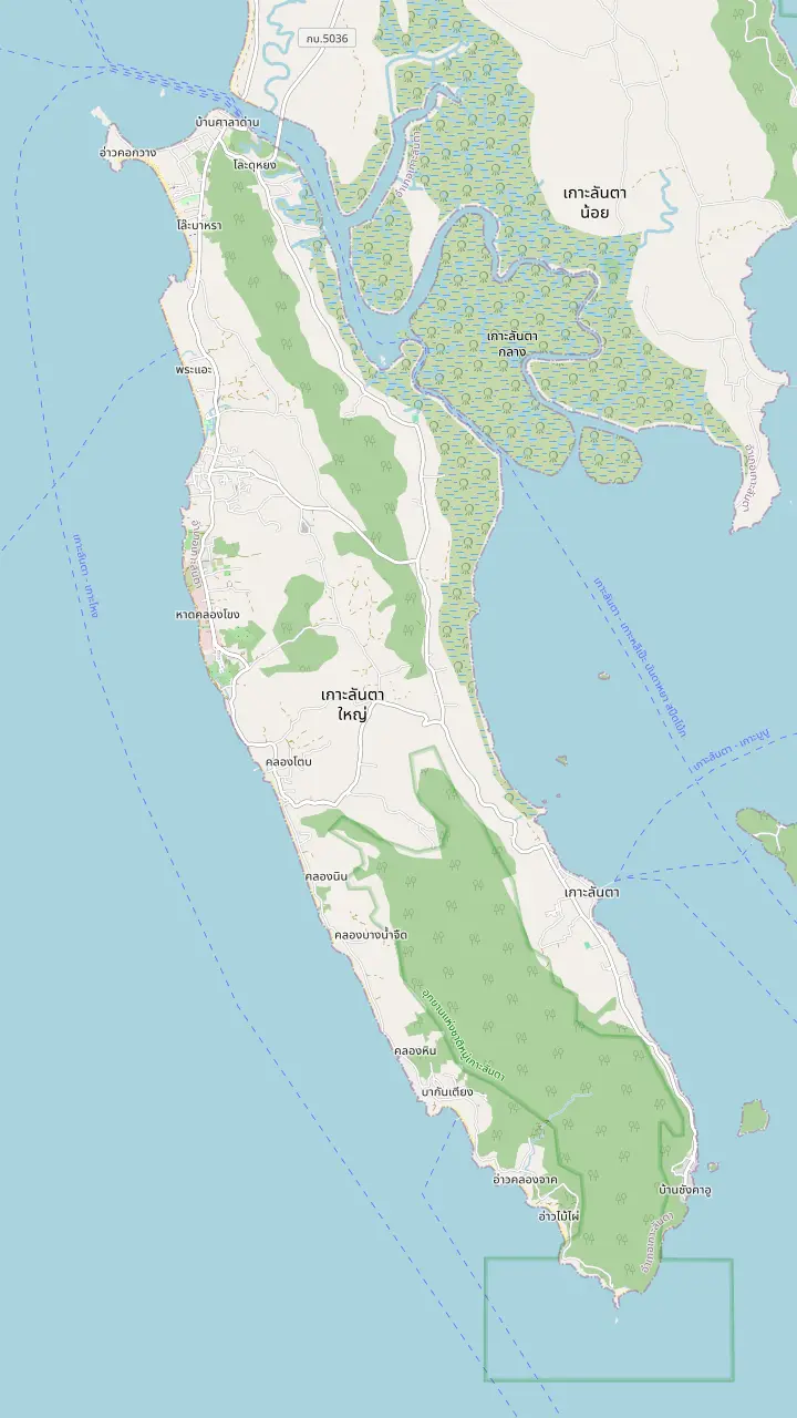
Klong Dao is one of two Ko Lanta beaches in the 2017 beach smoking ban TAT announced.
Google MapsPhra Ae, also called Long Beach, is said to have the softest and finest white sand of the Krabi beaches.
Google MapsKlong Khong sits between Phra Ae and Klong Nin on the west coast, and a listing's pickup round collects guests here at 8:20 AM.
Google MapsKlong Nin Beach, on the west coast, has a pickup point at 8:20 AM on one longtail day.
Google MapsKantiang is the earliest pickup point after Klongjark on one longtail listing, at 8:00 AM.
Google MapsBamboo Bay lies south of Kantiang Bay on the map, towards the Laem Tanot end of the island.
Google MapsLanta Old Town on the east coast is the island's capital; several longtail boat days start from its pier.
Google MapsBaan Saladan is where the car ferry and boats from the mainland arrive, and the main tourist office stands here.
Google MapsA paved road runs the length of the island to the park headquarters and the lighthouse at the southern end, the Laem Tanot side.
Google Maps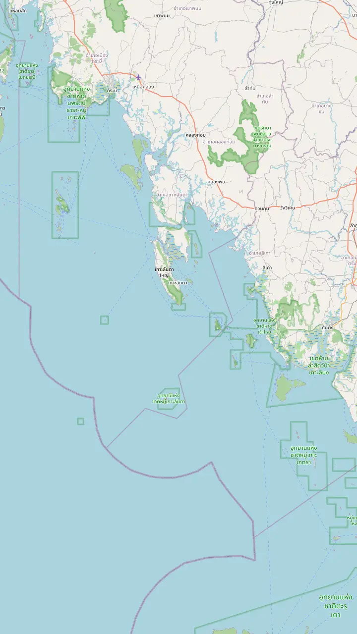
Baan Saladan is where the car ferry and boats from the mainland arrive, and the main tourist office stands here.
Google MapsLanta Old Town on the east coast is the island's capital; several longtail boat days start from its pier.
Google MapsA paved road runs the length of the island to the park headquarters and the lighthouse at the southern end, the Laem Tanot side.
Google MapsTAT places Ngai Island in Ko Lanta District, Krabi, and the park authority groups it with Ko Ma.
Google MapsKo Kradan belongs to Hat Chao Mai National Park in Trang, and TAT describes its beach as having no roads.
Google MapsKo Muk is listed in Hat Chao Mai National Park, and the Emerald Cave on the island is a doline that visitors may wade through.
Google MapsKo Rok sits in Mu Ko Lanta National Park, and the park closes it from May 16 to November 15.
Google MapsKo Ha, the five-island group, belongs to Mu Ko Lanta National Marine Park.
Google Maps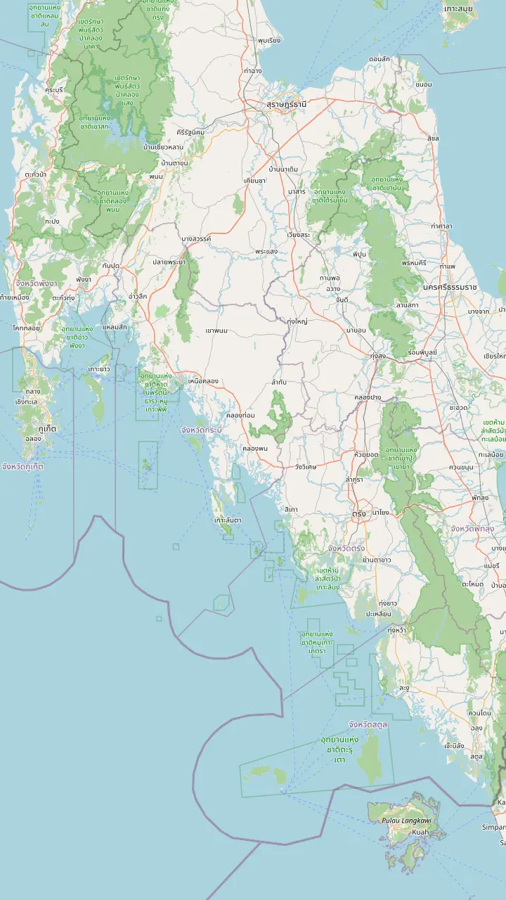
The airport on the Krabi side; one private transfer listing joins it to hotels on Koh Lanta.
Google MapsBoats to Ko Lanta leave Khlong Chi Lat Pier in Krabi at 11.00 and arrive about 13.00 for about 350 baht, according to the park authority.
Google MapsA boat leaves Ao Ton Sai Pier on Ko Phi Phi at 8.00 for Ko Lanta, arriving about 9.30, the park authority says.
Google MapsBaan Saladan is where the car ferry and boats from the mainland arrive, and the main tourist office stands here.
Google MapsLanta Old Town on the east coast is the island's capital; several longtail boat days start from its pier.
Google MapsTAT notes that Trang has a domestic airport and serves as a gateway to southern Thailand's quieter beaches.
Google Maps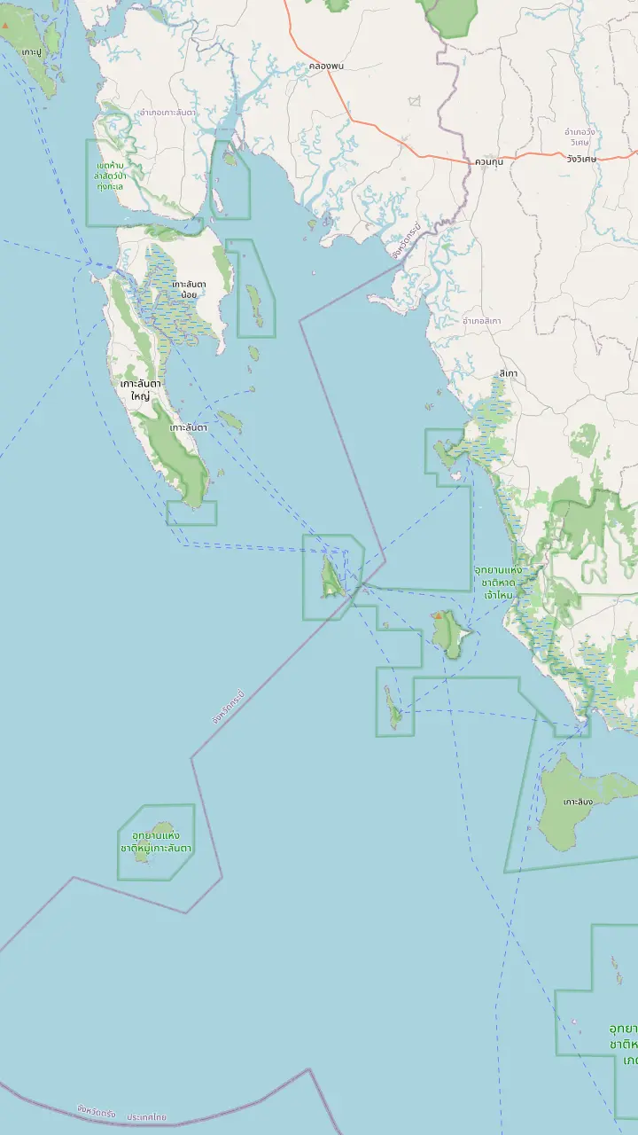
Lanta Old Town on the east coast is the island's capital; several longtail boat days start from its pier.
Google MapsKo Chueak is one of the Hat Chao Mai islands, and several longtail days make it the first stop.
Google MapsKo Waen is another island of Hat Chao Mai National Park.
Google MapsKo Muk is listed in Hat Chao Mai National Park, and the Emerald Cave on the island is a doline that visitors may wade through.
Google MapsTAT places Ngai Island in Ko Lanta District, Krabi, and the park authority groups it with Ko Ma.
Google MapsKo Kradan belongs to Hat Chao Mai National Park in Trang, and TAT describes its beach as having no roads.
Google MapsMap data: © OpenStreetMap contributors
Koh Lanta is a long island with beaches strung along one road. See which part suits you, where boats leave from and how to move around without a car.
Editorial team, kohlanta4islands.click · Updated November 16, 2026 · A 7 min read
Quick look
Start with the shape, because every choice follows from it. Ko Lanta Yai is 6 km across and over 30 km long, the tourism authority says, and its terrain mixes nine golden sand beaches with mangroves, waterfalls and forested hills.1 One paved road runs the island from north to south alongside the coast and gives access to the national park headquarters and the lighthouse on the southern tip.6 There is one spine, and where you sleep along it sets how far you travel for dinner, a boat or a bank.
Arrivals land in the north. The main tourist office is at Baan Saladan, where visitors arriving by car ferry or boat first come ashore, and the village has the island's highest concentration of banks, dive shops, markets, clinics and motorbike rental.2 On the east coast, Baan Koh Lanta, known as Lanta Old Town, serves as the island's capital and is where the post office stands.3 Between them and the lighthouse lie the beaches that most visitors come for.
The tourism authority also lists places to explore once you are settled, among them Aow Nui, Tanod Cape Viewpoint, Hat Kor Kwang, Hat Khlong Dawn, Hat Phra Ae, Tanod Cape, Baan Sriraya and the Sea Gypsy House at Baan Sangka U.7 Use that list as a starting set of names for the map above, and note that Hat Khlong Dawn and Hat Phra Ae are the western beaches the authority singles out by name.
Side by side
| Base | What is there | Good for | Note |
|---|---|---|---|
| Baan Saladan | Tourist office, banks, clinics2 | Arrivals, errands2 | North end2 |
| Lanta Old Town | Post office, capital3 | Local life3 | East coast3 |
| Hat Khlong Dawn | Named beach7 | Beach stays7 | West coast7 |
| Hat Phra Ae | Named beach7 | Beach stays7 | West coast7 |
| The park headquarters | Lodges and camping4 | Forest and sea4 | Southern tip6 |
| Ko Ngai, Kradan, Muk | Beaches, snorkeling5 | Seclusion5 | Boat access5 |
Beach and town names come from the tourism authority and the park authority; neither publishes ratings or room prices, so none are given here.7
The tourism authority sees Koh Lanta as a beach destination for several kinds of traveler, naming families, couples, backpackers and scuba divers, and describes a place that has not given in to overdevelopment while still offering plenty of rooms and activities.8 That description is a useful guide to choosing a beach: the island does not have one scene, it has a spread, and each stretch of sand along the road has its own mood.
For a first visit, start with Hat Khlong Dawn or Hat Phra Ae on the west coast, both of which the tourism authority names.7 Further south the road runs on toward the park headquarters at the southern tip, where the beach and the forest meet.6 As a rule of thumb of our own, families will want a beach close to services and couples and divers can travel further south for quiet.
Quiet is a real quality here, and one magazine's description reached the island's own authority. International Living called Ko Lanta a place of wild jungle and uncrowded beaches, and the tourism authority repeated it when the island was ranked the world's second best.9,10 A ranking from years ago is not a guide to this year's crowds, but it does describe the character that has kept visitors returning.
Temperature through the year
Average temperatures at the weather station near the national park, as the park authority states them: 24 in December, 28 over the year and 34 in March.11
Stay at Saladan if you want convenience. Arrivals land there, the tourist office is there, and the banks, markets, clinics and scooter rental are within walking distance.2 Saladan is a working village rather than a beach, so many visitors simply pass through, though several boat days begin or end at its pier, and one listing for a Kradan day names the Koh Lanta Old Town Pier as its start.
Stay in the Old Town for a taste of local life. The capital of the island stands on the east coast, and its post office is the place to send a card.3 Our own day's record lists the Lobster Monument among its drop-off places, and a Kradan listing starts from the Old Town Pier, so a room on this side of the island keeps you close to the boats.
A third choice is the park itself. Mu Ko Lanta National Park offers accommodation in both lodges and camping grounds, with a tent and equipment rental service and a restaurant.4 Its southern tip is reached by the paved road, and the park covers 25 islands in four groups with a total area of 134 square kilometers.6,12,13 Sleeping there is for visitors who want forest and sea over a resort
Pick by need
Choose what matters most to see where to look for a room first.
If I want banks, shops and a clinic nearby
Baan Saladan
The village has the highest concentration of those on the island.2
If I want a local town on the east coast
Lanta Old Town
It is the island capital and holds the post office.3
If I want a west coast beach
Hat Khlong Dawn or Hat Phra Ae
The tourism authority names both among the places to explore.7
If I want to sleep inside the park
The park lodges or camping
The park offers lodges and camping grounds with tent rental.4
If I want seclusion over services
Ko Ngai, Ko Kradan or Ko Muk
They offer beaches and snorkeling with even greater seclusion.5
Three bases
Practical
Services and arrivals
See the boat days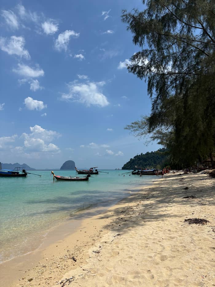
Beaches
The classic beach stay
See the boat days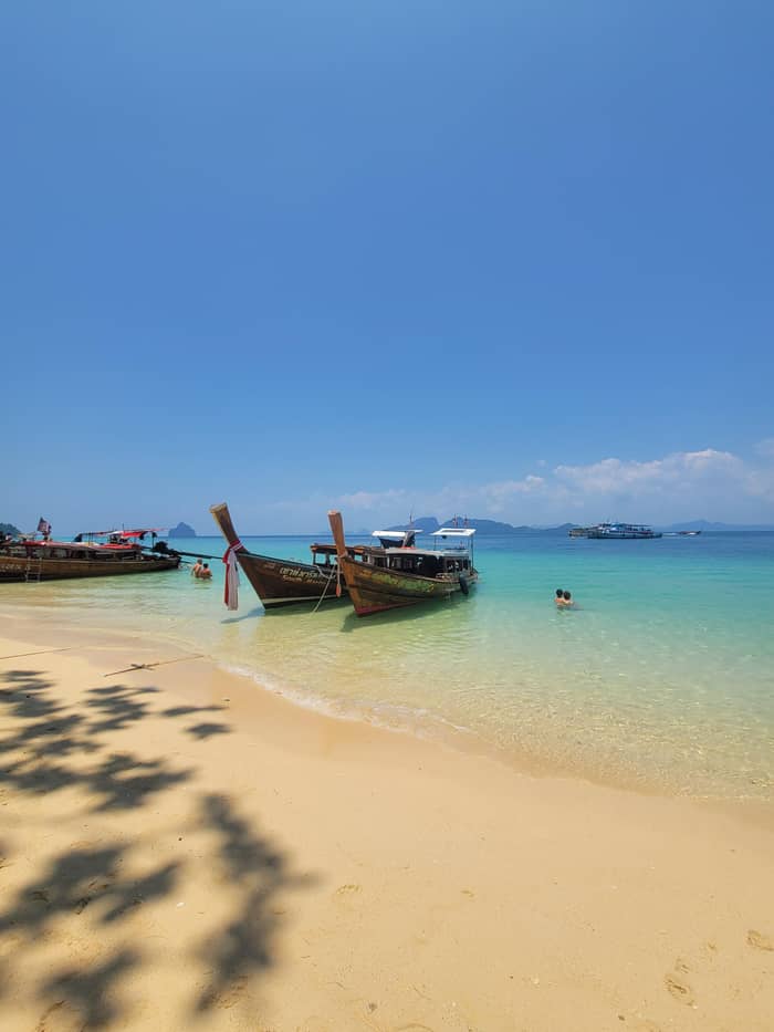
Seclusion
Quiet and remote
See the boat daysTravelers who search for Koh Lanta 5 star hotels will find that the island has resorts at the top of the market. The tourism authority says Koh Lanta has slowly developed to include some of Thailand's finest beach resorts.29 No source we can cite rates or ranks them, so this page names none and does not claim a star count for any property. We do not sell hotels, and what follows is guidance on how to choose.
Price levels follow the same rule. We found no official room-rate source for the island, and an invented figure would be worse than none. What you can do is compare like with like: choose your dates, then compare a beachfront room, a garden room and a park lodge for the same nights, and weigh the transfer cost to your boat day. The boat itself costs the same wherever you sleep, from $27 for the day sold here.
Book early for the busy weeks. Book rooms early for the busy months of December and January, as the tourism authority recommends, and look at the weeks on either side of the season if you want things quiet.25 Rooms and seats go together, so confirm your ferry or transfer once the room is held. Free cancellation on both gives you room to adjust if the weather or your plans change.
Price your group
Choose how many are traveling to price the boat days from any base.
Side-by-side: 3 options
Choose how many are traveling to price the boat days from any base.
≈
View≈
View≈
ViewConverted at the ECB reference rate, from-prices as listed by GetYourGuide. The precise amount is shown when you book.
Along the road
Arrival
Car ferry and boat arrivals first land here, near the tourist office.2
East coast
The island capital, with the post office.3
West coast
Named by the tourism authority among the beaches to explore.7
The road south
It runs the length of the island, parallel to the coast.6
The tip
Mu Ko Lanta National Park lodges and camping are here.4
How to get around Koh Lanta comes down to the paved road, which runs along the whole length of the island.6 A scooter is the independent choice, but the UK government is blunt about the risks: the WHO places Thailand near the top of the world's motorcycle fatality tables, and a helmet is required by law.30,26 Rental scooters in tourist areas are often unregistered, so check your travel insurance and the lease before hiring.27
The calmer choices are taxis, shared pickup trucks and transfers booked ahead. Private cars run from Krabi Airport in about 2 hours from $81, so most arrivals can be arranged before you leave home. On boat days the trip sold here picks you up at your hotel or meets you at the pier, so your own wheels are not needed for the islands.
Plan your days around distance. With one road and a length of over 30 km, a beach at the northern end and a viewpoint at the southern tip are a real drive apart.1 Group the stops you want by area, leave the south for a separate half day and keep an evening in your own beach. The island rewards the traveler who stays in one place longer instead of switching rooms.
Video
Danny & Diggy on YouTube · Playback files load only once you tap play.
wild jungle and uncrowded beaches that make it (among) the world’s most spectacular islands.
Before you book
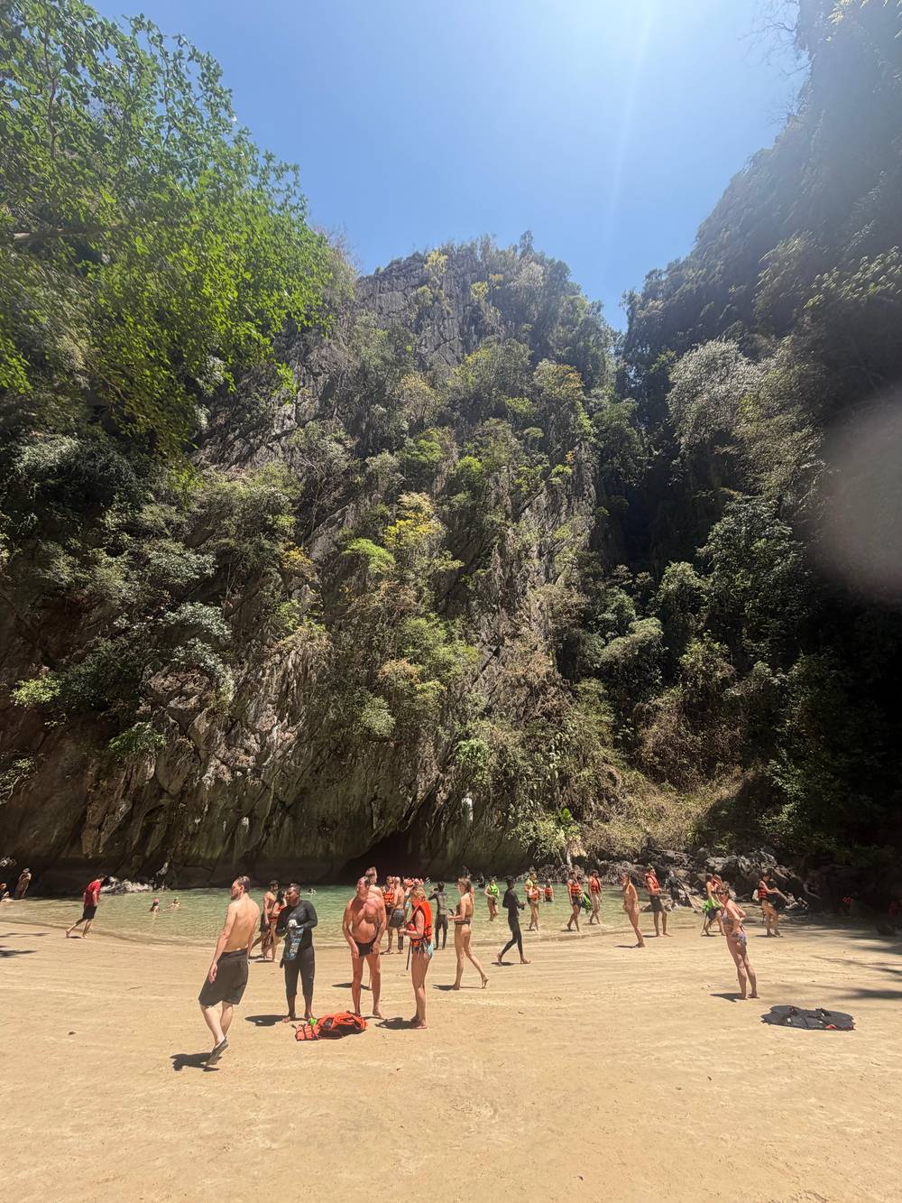
If the main island feels too big, the smaller ones to the south are an alternative. The tourism authority says that just south of Ko Lanta Yai lie Ko Ngai, Ko Kradan and Ko Muk, all of which offer beaches and snorkeling and even greater seclusion.5 Another TAT article suggests basing yourself on Ko Muk or Ko Kradan when exploring this coast, from where you can swim into the Emerald Cave.31
The trade-off is convenience. The smaller islands have fewer services than Saladan and rely on boats, and the park authority's list for Hat Chao Mai National Park names Ko Muk, Ko Kradan, Ko Waen, Ko Chueak and other islands as part of its coast.16 A stay there suits a traveler who wants quiet and is happy to plan around the sea.
Check the seasons before you commit. According to the 2024 national park closure list, Ko Muk, Ko Kradan, Ko Cheuk and Ko Wan are shut from 1 June to 30 September, and Tham Morakot is shut from 1 to 30 September.28 Closure dates shift from year to year, so confirm them with the park before booking a room on one of these islands.
FAQ
The tourism authority lists families, couples, backpackers and divers among the visitors it suits.8
The tourism authority says the village has the highest concentration of banks, dive shops, markets and clinics.2
The park offers lodges and camping grounds, with tents and equipment to rent.4
Listings name the Koh Lanta Old Town Pier and a drop-off at the Lobster Monument.
Booking early for December and January is the tourism authority's advice for ferries and rooms alike.
Sources
Further reading
Heading to Koh Lanta? Ask a real person here.